
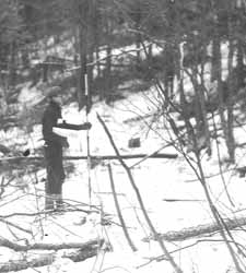
 Survey Crew along Highway Right-of-Way
Warren County Public Works Photographic Collection
Record Series: MAPS - HIGHWAY RIGHT-OF-WAYS
Dates: 1904 - PRESENT
Location: Warren County Records Storage & Archives & Warren County Clerk's Record Room
Format: Pre-1980 are blueprints; maps circa 1980 to date are mylar.
Arranged: By Highway Name, Map Number
Volume: Records Storage Center: 4372 items, 28 cubic ft
County Clerks Record Room: 22 cubic ft
Department: County Clerk
Legal Restrictions: None
Use Restrictions: Staff will access all records and must approve all requests for copies.
Historical Background:
One of the most significant pieces of state legislation in the 20th century having direct impact on county government was the enactment of the Consolidated Highway Act of 1908. Prompted by increased demand for improved transportation services, the 1908 law eliminated obsolete statutes, reorganized the state's department of highways, and focused increased attention on the construction of a system of state and county highways, public roads that were financed by public money. To it can also be traced the creation of the county Department of Public Works--one of the most powerful departments within modern county government. In accordance with the law, highway right-of-way maps were created and filed in the Office of County Clerk, in order that the public be appropriately notified of all acquisitions deemed necessary for highway construction and improvements. Earliest maps were typically rolled together according to highway name and were in blueprint format filed, while today's filings are mylar. A recent archival project has catalogued approximately 28 cf of a total of 50 cf of maps and transferred them to the Records Storage Center for permanent storage.
Description of Record Series:
Nearly all pre-1980, highway right-of-way maps on file in the Clerk's Office are created in blueprint format. Post 1980 maps are mylar. Both include: reputed owner name with adjoining properties identified, highway name, highway number, map #, map creation & file dates, surveyor name, description of property. Maps are rolled. Highway Appropriation Notices relating to the acquisition are
also on file and sometimes attached. CO-2 # 680.
Purpose of Record:
Provides a record of property and/or easements acquired for the improvement of public highways.
Other Formats: Items to be scanned.
Finding Aids: Series on inventory database, archives database, archival catalog.
Related Series: Maps-Highway, Civil Actions-Highway, Highway Papers, Highway Appropriation Notices, Public Works Photographic Collection.