
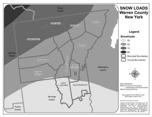
On the reverse of this paper is the Ground Snow Load Map for Warren County. Keep in mind any elevations above 1,000 feet, the ground snow load shall be increased from the mapped value by 2 psf for every 100 feet above 1,000 feet.
You can obtain the elevation figures from the Warren County GIS Spatial Data Viewer:
- Click on the town that you want
- Click on “Search for Parcel”
- Choose search type (new number, last name or address)
- Find the parcel in question
- On the right side of the page select “layers”
- Click on “20’ contours” and the elevation numbers will appear